October 2008
Monthly Archive
Monthly Archive
Maurizio 03 Oct 2008 | : Events, Google Earth, NASA WorldWind, Virtual Globes
Tuesday September 30 - Slot 1
Title: NASA WorldWind: Evolution from .net application to Java SDK
First slot, first demo of FOSS4G2008.
Someone had hinted “so to set the standard!”.
Well, the standard was below sufficiency. ![]()
Strangely enough for once I had prepared well and even rehearsed the demo to be sure I could do the best with my 10 minute slot.
I set up well in advance my magic local tileservice to feed images at a fast & furious pace. The first hint of trouble comes when one of the two large LCD screens, the one at my demo station, refuses to size correctly … planet Earth looks more like a banana than a globe. Not serious, a second screen further away is sizing correctly … and the audience moves across the room.
NASA World Wind (.net version) globe is rotating beautifully showing off the Global Clouds layer dominated by a mega-typhoon over Vietnam … great view! ![]()
“We have all experienced the first generation of virtual globes and the wonderful way they display more and more types and quantities of information … BUT they are all SINGLE and PROPRIETARY programs whose content and functionalities are dictated by the respective providers. Google (GE) and Microsoft (VE) control what we can see and how we see it”
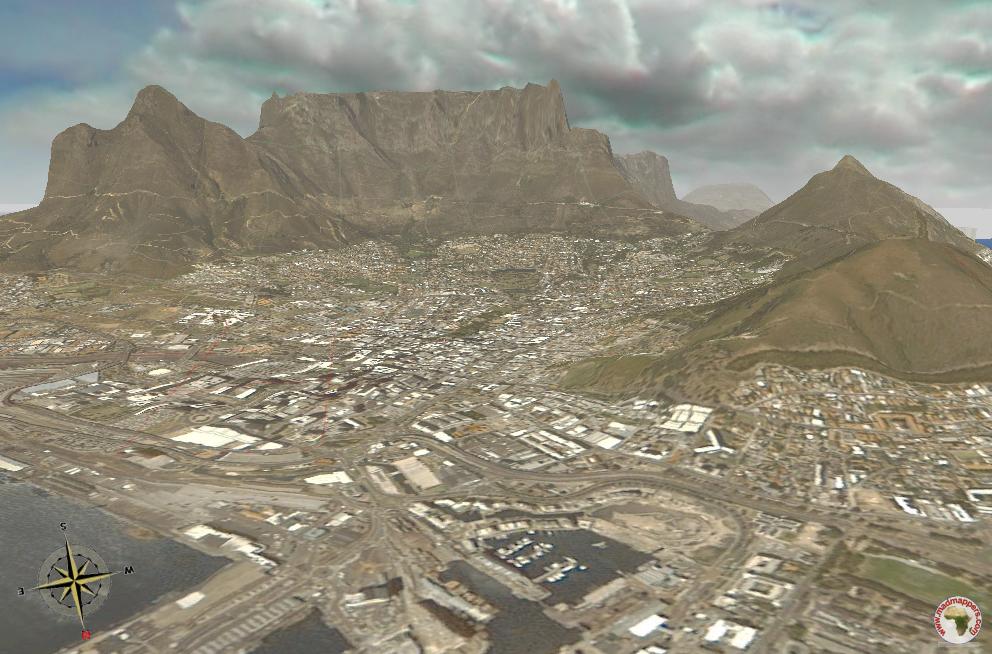
That went well … time to fly into Cape Town and show some of this …
… or this
…. damn! why is the mouse on the left of the keyboard? And why is the keyboard so much to my right … How did it get there? …. I try to gently pull the cable towards me but it is going to disconnect ![]()
” NASA Wold Wind started pretty much in the same way as a single program with limited functionalities still due to the fact that it is open source the community soon added more and more features. Content was a problem: although NASA provided the base imagery it was up to the user to provide imagery at higher resolution …”
Damn … I crashed ![]()
… why is the mouse cable not coming? is it fixed to the table? Let me cross my arms and try control the mouse with my right and keyboard with my left … oops I crashed again ![]()
I need to take that Motion Momentum off but the F11 key is too far for me to reach ![]()
” The feedback from users able to provide own content was that they required their own functionalities to achieve their own objectives”
No! I cannot control this stupid mouse with my left hand, I need to go static and try to carry on! Damn, my imagery is so beautiful and I will not be able to show it to anyone ![]()
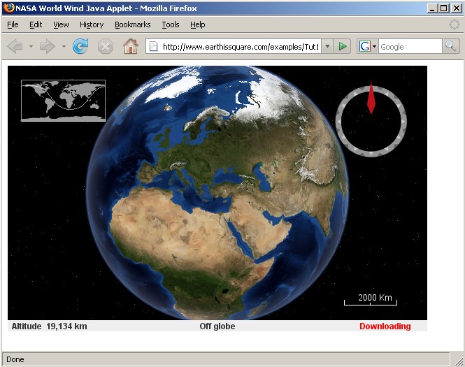
” World Wind changed its mission. From providing a single information browser to enabling a class of 3D geographic applications. In practice not 1 program but components to create programs. From NASA World Wind .net framework to World Wind Java multi-platform in a technology which can be part of any application … Can be a window in a web page such as this … ”
… ohh, no I cannot risk to crash again to show this

neither zoom over the convention center as I had planned to do …

I must skip all this ![]()
“… or can be extended by applications and web developers in true NET2.0 spirit.
With World Wind it is possible to include virtual globe technology in support of your objectives!
Remember: World Wind is NASA open source, the code being fully visible so that anyone can readily use it and extend it to serve any use”
I am told I have one minute … good it is almost over!
” World Wind developers can provide exclusive & custom solutions for user needs …”
What else? I have now lost my plot ![]()
I am not the multitasking type, I am not sure what I have have said and what I have not. I was too busy thinking about how to control the mouse with my left hand.
Ah, yes …. but then maybe I might have said it already …
“World Wind is a component! Cross platform and open source”
Is the minute finished?
What?
A presenter is not coming and I can have 5 minutes more?
I don’t want them …. what am I going to do with them if I can’t control my mouse? ![]()
I am unable to land a F16 on a San Francisco’s highway with my left hand!

…. all I can do is to point to this
http://worldwind.arc.nasa.gov/java/demos/
I am angry with myself. I had the opportunity of a lifetime to show how incredible my World Wind is and I did not take it. I should have done better, much much better ![]()
I offer some leaflets I had prepared for the occasion.
A couple of guys come to ask questions and while apologizing for letting WW down I offer to give a personal demo.
They loved it ![]()
Maurizio 02 Oct 2008 | : Events, GIS software, Google Earth, NASA WorldWind, Virtual Globes
Cape Town is currently hosting the 2008 Free and Open Source Software for Geospatial (FOSS4G) conference, an annual gathering of developers and users of open source geospatial software from around the world to discuss new directions, implementations and growing business opportunities in the field of open source geospatial software.
Conference Theme for 2008 is “Open Source Geospatial: An Option for Developing Nations“.
I am just back from the Mother City after presenting 2 demos and a lab with mixed results.
Was it worth? Definitely yes.
Being side by side with the heroes of osgeo and finally meet in person legends like Frank (GDAL) and Chris (OpenLayers) was a tremendous experience. I was pleasantly surprised … they are actually very nice guys ![]()
Biggest lesson learned? Internet connections, supposedly the best in Africa, suck ![]()
Now everyone knows. And hopefully for a few weeks I will not be asked to upload any 500Mb file ![]()
Next … some details about my activities at FOSS4G2008!
Maurizio 02 Oct 2008 | : Uncategorized
I am no good at this blogging thingy … for a number of months I had lost my blog password and I could neither reset the password or log in ![]()
Well, I discover now that the problem was the incorect username rather than the password ![]()
So now I am back in action … it’s going to take some time to brings things up to date, lots has been happening ![]()
 |  |  |  |  |  |  |  |
 |  | ||||||
| By N2H | |||||||
