OziExplorer now with Google Earth background
Posted by Maurizio on 16 Dec 2009 at 01:20 am | Tagged as: Google Earth, Maps, NASA WorldWind, Satellite Imagery, Virtual Globes
Quite embarassing! Old News!
I must have been the last one to find out. Still there might be someone around who is more out of touch than I am and might be interested in this.
OziExplorer now supports (experimentally) a number of internet maps including Google Maps (streets only), OSM - Open Street Map and Virtual Earth (streets, satellite and hybrid). In addition there is a plug in which allows having Google Earth images as a background.
I confess that for some time (too long ![]() ) I have been too busy for exploring the continent and I haven’t had the chance to use OziExplorer. It was a complete surprise when today I stumbled in OziExplorer - Google Maps and Google Earth
) I have been too busy for exploring the continent and I haven’t had the chance to use OziExplorer. It was a complete surprise when today I stumbled in OziExplorer - Google Maps and Google Earth
And so I dropped whatever I was busy doing and decided to give it a try: first I had to download the latest version of OziExplorer (version 3.95.5g) and then the required additional installs for Google Maps and Google Earth .
I followed the instructions step by step and I had no problem whatsoever. If you do then take a step back, repeat to yourself that after all you don’t know everything, get a pencil and start all over again, this time ticking each step in the instructions after complying.
I was actually expecting things to be complicated and to go wrong. I was extremely surprised when after following the instructions a screen with street-maps suddenly appeared

NICE! ![]()
What about a track?

That was easy!
Let’s check out the other layers available:
OSM:

Excellent! Pity that Google Maps images are restricted. Let’s check out Virtual Earth - hybrid layer:
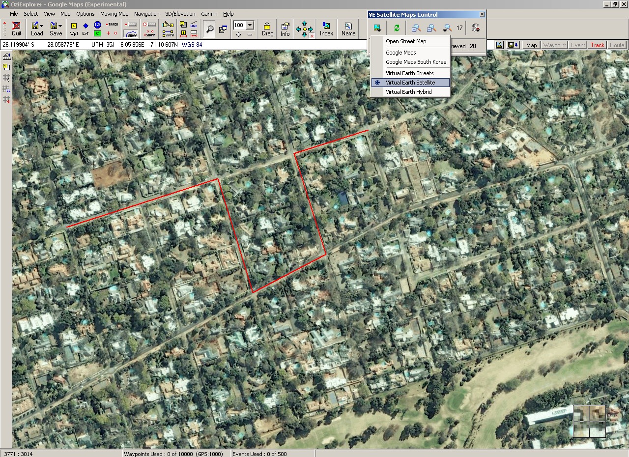
This is very unexpected! Imagery is more up to date than Goggle’s, at least in my Johannesburg suburb. May 2008 I think, Google maps is at least 6-7 months older than this.
How’s the maximum zoom?

Level 19, 30cm/px … that’s actually an overzoomed 60cm/px image, same resolution as Google. Who needs Google?
Well, in any case there is the Google Earth plugin still to test. It requires the Google Earth to be installed and set up for DirectX rather than OpenGL. Easy change in the GE option menu.

Nicer colours, but then that’s probably end October 2007 after lots of rain and VE image was in the middle of the dry South Africa winter. Still somehow Google Earth has always had the ability of rendering images prettier than the source image.
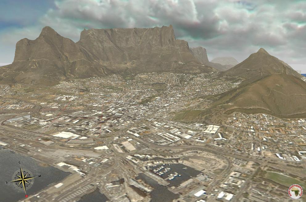
The temptation is too much: let’s go 3D !
Big mistake. After all this GE plugin is a hack which “steals” via DirectX the image from GE which runs side by side.
There are do-s and don’t-s and switching between OE and GE in Windows task-bar is definitely a DO NOT.
After crashing OE I am more careful: I can sense that the OE-GE-DirectX combination is highly unstable. Tracks flicker, tilt resets on it’s own in some location nearby ….

… and GE elevation model sucks in any case, no wonder why I prefer Google Maps 2D to this Google Earth “baby” virtual globe ![]()
Let’s go to Cape Town, Table mountain is my favourite 3D spot

… beutifull (expensive) images but the improved terrain model still sucks, call me sentimental I prefer any day “my” old 5 years old open source NASA World Wind …
… with uglier (Spot 5) French imagery.
Still who needs 3D when there are 360 hyper definition images around?

Make a point of checking out 1st Hyper Definition Image at Virtual Africa
Lots of good old fashioned stitching can do wonder!
One response to “OziExplorer now with Google Earth background”
Leave a reply
You must be logged in to post a comment.


parure de stylo mont blanc
casque beats maillot barca by dr dre je n’ai pas vu le porter ou quelq maillot retro ue chose comme ça pour probablement un an et demi,maillot barca
Elle aimait le golf, la natation,maillot retro, la lec maillot gardien ture et de socialiser avec…