Maps
Archived posts from this Category
Archived posts from this Category
Posted by Maurizio on 21 Nov 2005 | Tagged as: Events, Maps, NASA WorldWind, Virtual Globes
This is the title of our contribution to AfricaGIS 2005. The paper was co-authored by Patrick Hogan, the NASA LT World Wind project manager and attracted positive response by the African community. A number of African countries have expressed an interest in a customized World Wind country version.
You can view the paper by clicking here!
More information on the World Wind Africa initiative can be found at
Comments Off
Posted by Maurizio on 21 Nov 2005 | Tagged as: Events, Maps, NASA WorldWind, Virtual Globes
Over over 600 delegates and exhibitors from various parts of the World converged on the CSIR International Convention Center in Pretoria (Tshwane - South Africa) to attend the biennial continental GIS conference. One week (31 October to 4 November 2005) during which government, industry and international institutions met to assess the situation, look at new ideas and identify a way forward.
Madmappers was there to listen and learn how “things” are working out and what the future will bring us. And to present to an international audience the World Wind Africa initiative in association with NASA LT.
You can find more on our AfricaGIS2005 page
Comments Off
Posted by Maurizio on 03 Oct 2005 | Tagged as: Events, Maps, NASA WorldWind, Satellite Imagery, Virtual Globes
In occasion of the World Space Week (4-10 October 2005) WorldWind South Africa was introduced in South African schools.

This electronic atlas of Southern Africa fruit of the collaboration of MadMappers, NASA, the SA Department of Science and Technology and coordinated by the SA Space Organization.
The launch in Pretoria, Durban and Cape Town was attended by Frank Frank Kuehnel (NASA Learning Technologies) who also gave a preview of of the Moon in 3D. In fact World Wind not only allows you to view the Earth in 3D, but also brings the universe to a desktop PC and is thus ideal in the creation of a “space culture”. In Frank’s own words the South African version simply showed how big the potential is for other people to step in and contribute! I think this opens a new paradigm of data distribution.
Mark Doherty from ESA ESRIN (the European Space Agency Centre for Earth Observation) was highly interested in MadMappers’ World Wind South Africa as a medium to bring ESA data to Africa. Mark extended an open invitation for MadMappers to present the project at ESA ESRIN headquarters in Frascati, Italy.
… will we ever be able to afford the trip? …
WorldWind is an open source 3D interactive world viewer created by NASA’s Learning Technologies project and released in mid-2004. It is now developed by NASA staff and open source community developers.
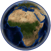
Essentialy WorldWind is a 3D “desk globe” which allows any user to zoom from outer space into any place on Earth. By simply using the mouse, the user is able to rotate the Earth or zoom closer to any point on the surface. WorldWind leverages satellite imagery and elevation data to allow users to experience Earth terrain in visually rich 3D, just as if they were really there, virtually visiting any place in the world. In actual fact WorldWind is truly an interplanetary tool capable of visualizing “other worlds” such as the Moon, Mars, Venus and Jupiter and then go on to explore the far reaches of the universe itself.
MadMappers’ aim is to offer African users an open source customable platform on which to display spatial information relative to their country. World Wind Africa servers will eventually supply a wide selection of data, ranging from topological maps to vector data, from aerial photography and very high resolution imagery to DEMs.
Special thanks to the Free Earth Fundation and the World Wind Community (in particular to Nowak, f0urtyfive and Bull_[UK]) for making this project possible.
NASA World Wind Version 1.3.5 (May 12, 2006)
(58,8 MB download)
Posted by Maurizio on 05 Sep 2005 | Tagged as: GPS, Maps, NASA WorldWind
AfricaTopo is a Mad project aimed at creating a 20m contour map of the African continent for use as a background map on a GPS. The project is well under way and the first step has now reached completion: South Africa.
The mapset includes 20m contour lines, elevation points, trig beacons, rivers, water areas and coastline. The set is compiled transparent so that it can be used in conjunction with other GPS maps e.g. overlaid on road maps on the GPS. More information can be found at
http://www.madmappers.com/AfricaTopo/AfricaTopo1.htm
As a bonus we have included on the AfricaTopo CD the latest version (ver.1,32) of NASA World Wind free 3D interactive map of the Globe with the plug-in for your GPS.
We thank the Chief Directorate of Surveys & Mapping of South Africa for providing the data thus making this first step possible and all their staff, Sue and Raoul in particular, for being extremely patient and helpful. It is remarkable how much passion for GIS and mapmaking can be found at CD:SM, it is rare to meet someone who has fun at work!
Posted by Maurizio on 23 Mar 2005 | Tagged as: Maps
Complete set for FREE download!
The complete 1:50.000 South African map series is available for download: 2175 maps totalling more than 7Gb.
Courtesy of Surveys and Mapping of South Africa, the electronic maps are in geographic (Lat/lon) projection and collar cropped for mosaicking. They are geo-calibrated for use in OziExplorer. In addition a world file is also present.
This is not a quick download task and if your web connection is not so fast or you have a cap do not despair: the complete MadMappers South African collection scale 1:50.000 on DVD set is only R 450 plus postage. Check the mapsets on CD section for more details.
 |  |  |  |  |  |  |  |
 |  | ||||||
| By N2H | |||||||